

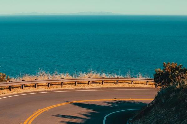
California’s Pacific Coast Highway is best experienced slowly. One moment you’re driving past a quiet beach town; the next, the road bends above cliffs with the Pacific filling the horizon. The classic San Francisco-to-Los Angeles stretch combines these dramatic changes with coastal walks, wildlife, and places worth staying overnight.
This Pacific Coast Highway road trip guide sets out a realistic five-day route, the most rewarding stops, and practical choices that matter more than simply collecting miles.
Where Does the Pacific Coast Highway Run?
California State Route 1 stretches from Dana Point in Southern California to Leggett in the north. The name Pacific Coast Highway is used for some sections, while others have different local names. For a first trip, the journey between San Francisco and Los Angeles includes many of the famous coastal sights without requiring a drive across the entire state.
Driving south keeps the ocean on your right along many stretches, making designated pullouts easier to access. Northbound is still an excellent option. Whichever direction you choose, remember that parts of the journey use inland-feeling roads or run alongside US 101 rather than following the water continuously.
A Five-Day Pacific Coast Highway Itinerary
Day 1: San Francisco, Santa Cruz, and Monterey
Leave San Francisco early and follow the coast toward Half Moon Bay, allowing time to stop at a beach overlook. Continue to Santa Cruz for lunch or a walk by the shore, then head toward Monterey. This is a scenic travel day, not a race to reach your hotel.
Stay overnight in Monterey or Pacific Grove. Both put you near waterfront walks and tomorrow’s departure point. Keep an eye out for sea otters from public viewing areas, giving wildlife plenty of space.
Day 2: Carmel and the Big Sur Coast
Begin in Carmel-by-the-Sea or at Point Lobos State Natural Reserve, which has beautiful coastal trails but limited parking. Continue south past Bixby Creek Bridge, one of Big Sur’s unmistakable landmarks. Stop only at legal turnouts, never on the road or across restricted shoulders.
The road winds through cliffs, redwood pockets, and ocean viewpoints. If access is available, Julia Pfeiffer Burns State Park is known for the view of McWay Falls. The falls are viewed from above; the beach below is not open to visitors. Allow most of the day for this short-looking section because curves and sightseeing can be slow.
Day 3: San Simeon, Cambria, and Morro Bay
When the highway is open all the way south, continue toward San Simeon. The elephant seal viewing area near Piedras Blancas offers a chance to watch these enormous animals from designated viewpoints. Stay behind barriers and never approach the seals.
Hearst Castle is worth considering if you enjoy architecture and history, though its guided tours require advance planning. Finish the day in Cambria for a quieter village atmosphere or Morro Bay for a lively waterfront beneath Morro Rock. These make comfortable overnight bases after Big Sur.
Day 4: San Luis Obispo to Santa Barbara
Take a relaxed morning around San Luis Obispo County before continuing south. Some stretches run on US 101, so expect a mix of coast, inland hills, and developed areas rather than uninterrupted ocean views. Santa Barbara’s waterfront, downtown streets, and restaurants make it a rewarding place to finish the day.
Day 5: Ventura, Malibu, and Santa Monica
Continue through Ventura toward Malibu and Santa Monica. Stop at a public beach such as Zuma Beach if you want one final long walk. Santa Monica Pier provides a recognizable finish to the California coast drive, with the city and ocean side by side.
Los Angeles traffic can change your arrival time dramatically. If you have an evening flight, allow a generous buffer instead of squeezing in extra PCH stops.
How Much Driving Time Should You Allow?
The scenic San Francisco-to-Los Angeles route may take roughly nine to eleven hours behind the wheel without sightseeing, depending on traffic and the exact roads selected. Those hours are best spread across several days. Three days is possible but rushed; four or five is more comfortable, and a full week leaves time for longer hikes and detours.
A useful planning trick is to choose just one major scheduled activity on your Big Sur day. A photo stop can become a half-hour break, and a short trail may take longer when parking is busy.
Road Closures Can Change Your Entire Plan
Highway 1 through Big Sur is vulnerable to landslides, severe weather, repair work, and wildfires. Following fire-related closures in 2026, the Cambria-to-Carmel road reopened in September, but conditions can change again. Before departure, check Caltrans QuickMap for road access and California State Parks notices for individual trails and facilities.
Open pavement does not mean every nearby attraction is open. Some Big Sur trails remained restricted during wildfire recovery even after driving access returned. Obey all signs and avoid relying on old photos, saved itineraries, or an estimated arrival time from a mapping app alone.
For example, if Highway 1 closes between Big Sur and San Simeon, there is no quick parallel ocean road. You may need to return north, connect with US 101 inland, and approach the southern destinations separately. Confirm the through-route before booking a nonrefundable stay on the far side of Big Sur.
Best Season and Essential Preparation
Late spring and early autumn often suit a highway 1 road trip, with comfortable sightseeing conditions and a balance of daylight and crowds. Summer offers long days but busy viewpoints and accommodations. Winter can be quieter, though rain and storm-related closures require more flexibility. Coastal fog is possible even in summer.
Bring layers, water, a car charger, and offline maps. Fill the tank before remote stretches of Big Sur, where fuel and phone coverage can be limited. Reserve popular lodging early, especially for summer weekends.
For additional planning, a California road trip checklist, a dedicated Big Sur travel guide, and a roundup of the best California scenic drives can help you select worthwhile detours without overloading the schedule.
Frequently Asked Questions
Is Highway 1 the same as the Pacific Coast Highway?
The names are often used interchangeably by travelers, although Pacific Coast Highway formally describes certain stretches and Route 1 has different local road names along California.
Should I drive the route north or south?
Southbound places the sea on the right on many scenic sections and can make designated pullouts more convenient. Northbound is equally scenic and may fit your travel bookings better.
Can you see Big Sur in a single day?
Yes, when roads are open. Give yourself a full day for viewpoints and a short walk rather than trying to fit in several lengthy hikes.
Where should I stay overnight?
Monterey or Pacific Grove, Big Sur or a reachable nearby base, Cambria or Morro Bay, and Santa Barbara form a practical sequence. Choose according to budget and current road access.
Enjoy the Journey, Not Just the Finish
The magic of a Pacific Coast Highway road trip lies in the unplanned moments: an ocean overlook, a harbor lunch, or an extra hour spent watching the waves. Build your itinerary around realistic driving days, check the road before entering Big Sur, and leave room for California’s coastline to surprise you.
